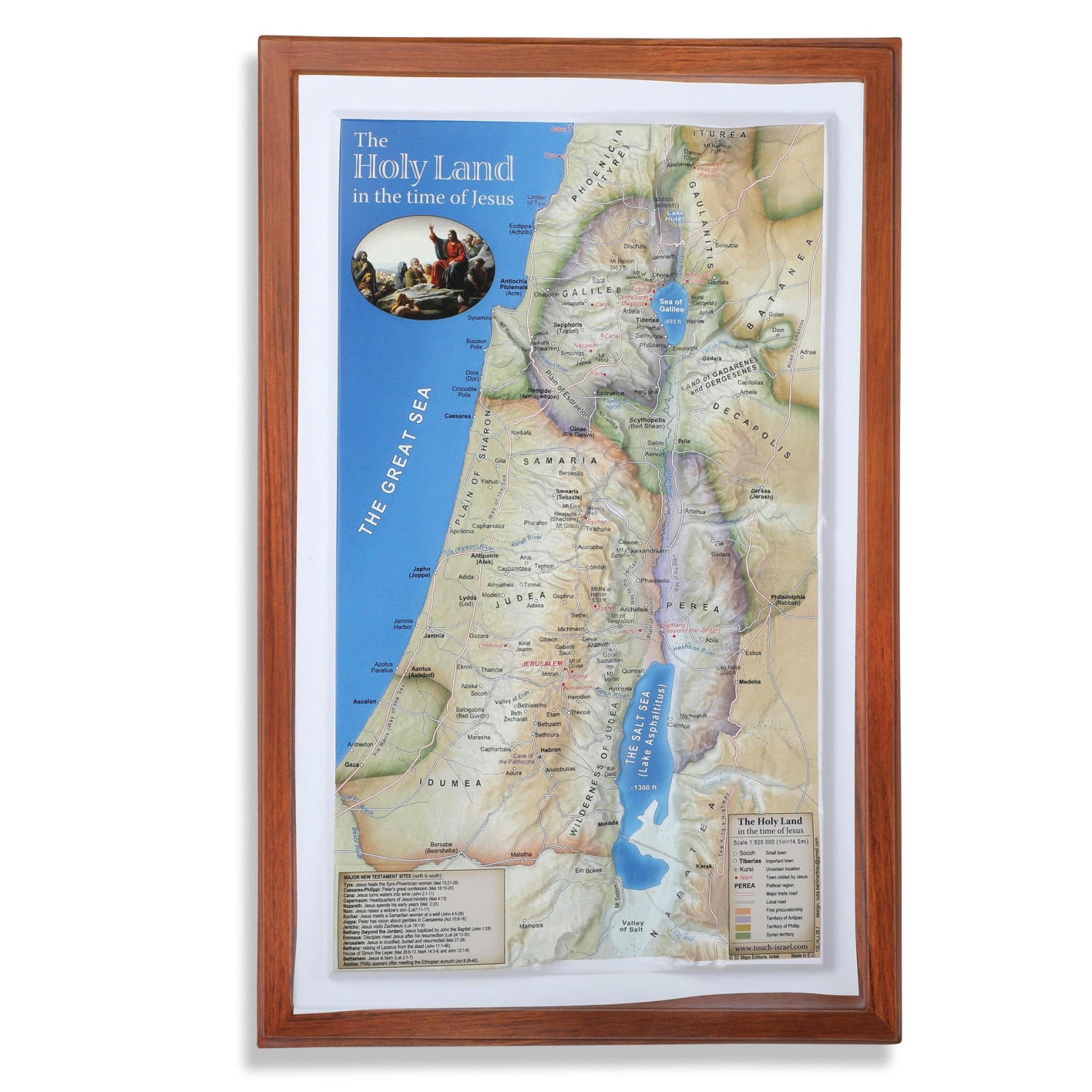
This amazing topographical map displays names the cities, rivers, and ports of what they were during the time of Jesus. This map is an excellent tool to use while reading the bible or teaching a class – great to have in the home or classroom.
This item can be bought in multiples.
product
https://www.myjerusalemstore.com/books/the-holy-land-in-the-time-of-jesus-topographical-map-104429The Holy Land: In the Time of Jesus Topographical Map https://www.myjerusalemstore.com/media/catalog/product/j/p/jpt-16602.jpg12.9512.95USDOutOfStock/Books/Holy Land Gifts/Israel Maps and Guides/Holy Land Gifts/Holy Land Gifts/Souvenirs From Israel/On Sale/Books/Holy Land Maps608960916099610062826526<p><strong>Size:</strong> 14" x 9" / 35.5 cm x 23 cm</p>
<p>This amazing topographical map displays names the cities, rivers, and ports of what they were during the time of Jesus. This map is an excellent tool to use while reading the bible or teaching a class – great to have in the home or classroom.</p>
<p>This item can be bought in multiples. </p>USD00add-to-cartPalphot